
The History of Gilbert, AZ: From Farming Town to Modern Suburb
The history of Gilbert, AZ, began as a small railroad stop in the early 1900s and grew into a major residential center in the Phoenix metropolitan area. Today, the local real estate market reflects that rapid growth, with the median home sale price sitting around $579,000. Buyers working with the best real estate agent in Gilbert, AZ will find historic properties near the downtown core alongside expansive master-planned communities on the town's outer edges.
Buyers looking at homes in the area often notice the deep agricultural roots still visible in the town's layout and architecture. The municipality's evolution shaped local zoning, property styles, and the infrastructure that connects neighborhoods to the rest of the Valley.
How a Railroad Siding Created an Agricultural Hub
In 1902, William "Bobby" Gilbert provided land to the Phoenix and Eastern Railroad to establish a local rail siding. This simple transportation stop formed the geographic center of what would become a successful farming community. By 1910, Ayer's Grocery Store opened near the tracks, providing the area's first retail shop and housing the local post office.
Water infrastructure transformed the arid desert landscape into productive farmland. The construction of the Theodore Roosevelt Dam and the expansion of local canal systems allowed farmers to irrigate their crops reliably. During this period, Mormon pioneers who had left colonies in Mexico arrived in central Arizona, settling in the area to farm the newly irrigated land.
Becoming the Hay Shipping Capital of the World
Between 1911 and 1912, local farms produced enough alfalfa to make the town a primary supplier for the United States military and mining camps. The Arizona Eastern Railway allowed growers to load massive quantities of hay for their horses and livestock, shipping it across the country. This output earned the municipality the title of the "Hay Shipping Capital of the World" prior to the 1920s.
Agricultural production soon expanded beyond alfalfa to include cotton and dairy. As the local job market and economy stabilized around these cash crops, residents sought formal municipal organization. The State of Arizona officially recognized the municipality when it incorporated on July 6, 1920, establishing a formal town council to manage future growth.
The Shift from Homesteads to Master-Planned Communities
Early residential construction in the area consisted almost entirely of agrarian homesteads built to withstand the desert heat. Many of these original houses featured sleeping porches, allowing residents to sleep outside during the summer months before the invention of residential air conditioning. These large farm parcels defined the local property landscape for decades.
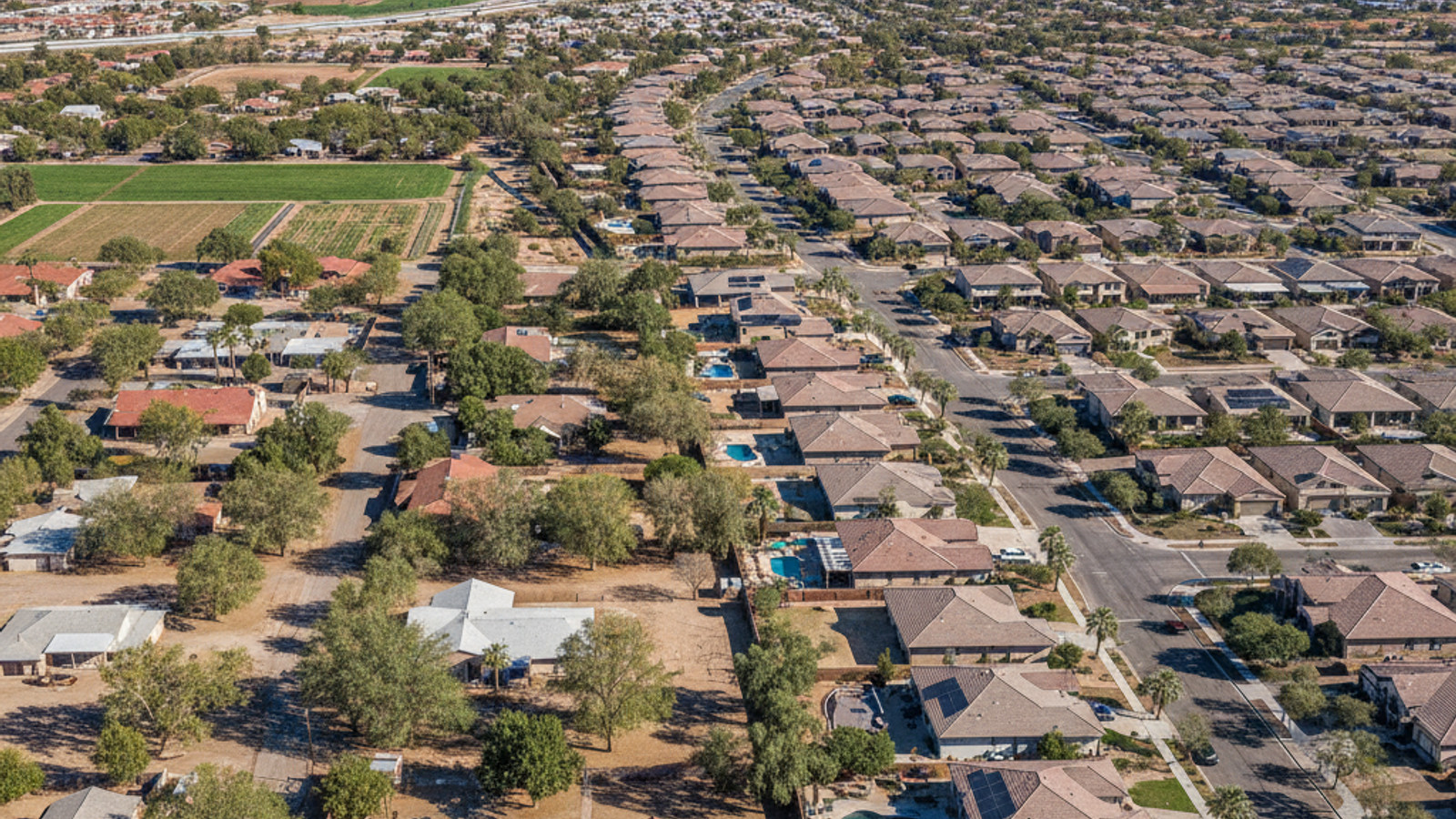
By the 1970s, the town council began approving shifts in land use from dairy farms to residential subdivisions to accommodate regional population forecasts. The town's borders eventually expanded to cover 53 square miles, absorbing former agricultural land into modern housing tracts. Today, buyers will find an active real estate market with roughly 1,000 homes available for sale at any given time, and properties typically spend an average of 46 days on the market.
Developers have occasionally integrated the area's farming history into modern residential design. Agritopia, a planned community built in the early 2000s, surrounds a working farm and utilizes architectural styles reminiscent of early 20th-century homesteads. Buyers interested in this type of neighborhood should work with an agent familiar with local homeowners associations and specific subdivision rules.
Civic Projects That Shaped Local Infrastructure
The establishment of Gilbert Elementary School in 1913 marked the beginning of a dedicated local education system. This single building eventually grew into the Gilbert Public Schools district, which now serves tens of thousands of students across multiple municipalities. As the population increased, town planners focused on adding public amenities to support the residential expansion.
Several major municipal projects have defined the town's physical layout over the past four decades:
Freestone Park: Opened in 1988, this was the municipality's first major public park, providing recreational space that helped attract residential developers to the surrounding parcels.
Riparian Preserve at Water Ranch: Completed in 1999, this 110-acre facility combines municipal water management with wildlife preservation and public trails.
Loop 202 SanTan Freeway: The main portions of this highway opened in 2006, directly connecting local neighborhoods to the broader Phoenix metropolitan area.
Access to the Loop 202 remains a major selling point for buyers evaluating properties in the southern half of the town. Homes located within a few miles of the freeway on-ramps often see strong demand due to the straightforward drive into Phoenix or Chandler.
The Growth of the Downtown Heritage District
Downtown Gilbert, now known as the Downtown Heritage District, centers around the original commercial buildings along Gilbert Road. During the district's modernization over the past twenty years, the town council prioritized the preservation of historic architecture. Modern dining and retail businesses operate out of brick buildings designed to match the early 1900s aesthetic of the original farming community.
The original Gilbert High School building stands at the southern end of the district. Built in 1913, it was repurposed and opened as the Gilbert Historical Museum in 1982. Several sites within the immediate area are listed on the National Register of Historic Places, protecting them from future commercial redevelopment.
Real estate near the Heritage District commands a premium due to the walkability and proximity to these restaurants and shops. Sellers in this central corridor often see homes go under contract quickly, especially since local market data shows that homes on average sell for about 98.3% of their list price.
Frequently Asked Questions About Gilbert's History
When was Gilbert, AZ founded and how did it get its name?
William "Bobby" Gilbert provided the initial land for a railway stop in 1902, giving the future municipality its name. While it operated as an unincorporated farming hub for 18 years, the town officially incorporated in 1920 to establish formal zoning and manage its rapid expansion.
What is Gilbert, AZ famous for, particularly its agricultural history?
The municipality earned the title of the "Hay Shipping Capital of the World" during the early 1910s by supplying massive quantities of alfalfa to military and mining camps. Today, that agrarian legacy draws buyers to communities like Agritopia, where modern subdivisions incorporate working community farms and heritage architectural styles.
What is the oldest building or historic place in Gilbert, AZ?
The original Gilbert High School, constructed in 1913, remains the oldest standing structure in the municipality. Now operating as the Gilbert Historical Museum, the building anchors the southern edge of a commercial district where strict preservation rules protect historic properties from demolition.
Is Gilbert, AZ considered a Mormon town, and what is its religious demographic?
Mormon pioneers from colonies in Mexico were among the first to settle and farm the area in the early 1900s. Today, the town is home to a variety of places of worship, including a prominent Latter-day Saint temple.
When did Gilbert transition from farming homesteads to modern master-planned communities?
The shift accelerated in the 1970s when officials began converting dairy farms into residential plots to meet surging housing demand. Anyone purchasing in these modern subdivisions should review the specific HOA guidelines, as rules regarding property modifications vary significantly between the original 1970s tracts and newer master-planned developments.
How did the historic Gilbert Heritage District evolve into the downtown area it is today?
Town planners focused on adaptive reuse, transforming early 20th-century agrarian buildings into a walkable commercial center. Because properties near the district frequently sell for nearly full list price and spend fewer than 46 days on the market, prospective buyers targeting this corridor should prepare for competitive bidding.